Aerial Topography
Our UAS can capture topography information, like the product shown above which displays a high-resolution hillshade for visualization, along with a derived map of roof slopes.
Close-up comparison of Lidar (orange) and drone-derived (red) 1’ contours. Click the image to enlarge.
FluidState’s drone can create highly accurate contours - quickly - for large sites. The layout below (available as a full-size PDF - click the image or button below it) shows a comparison between Lidar-derived contours and those created by the drone. In some instances, the drone-created contours pick up on details that the Lidar contours generalize over. Using high-accuracy GPS units like the one employed for this project by Spencer Harris of Vermont Contours, surface information can be brought into a specific datum and projection and line up with other survey or geographic data.
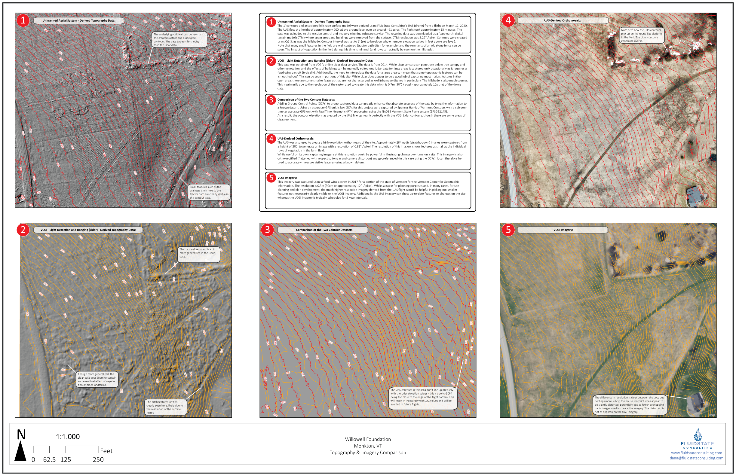
This layout is a detailed comparison between Lidar-derived contours and drone-created topography (and imagery) for a 21 acre open field in Monkton, VT. The flight was conducted during a two hour window. Contours were brought into the VT State Plane projection using Ground Control Points GPS’ed using high-accuracy equipment by Spencer Harris of Vermont Contours surveyors.
Why Use Drone-Created Contours?
In many cases, Lidar-derived contours are sufficient for your project. After all, they’re available in most locations and are generally free. But what about data for sites that have evolved or changed since the Lidar surface was created? Capturing topography by ground survey can be time-consuming and costly. FluidState’s drone can fly large sites (the above 21 acre site was flown in 18 minutes) to generate both high-resolution imagery and topography via photogrammetry that can be equal to or better than Lidar data, especially when combined with high-accuracy GPS Ground Control Points. FluidState can provide high-resolution Imagery (<1.0” / pixel in certain cases) as well as surface data to create:
1’ contours (available as a variety of common GIS files and CAD-compatible files (DXF)
High-resolution Digital Terrain Models (~3.0” / pixel)
Hillshades/Slope/Aspect Surface
Point clouds
3D Models
Our goal is provide you with the best data possible for your planning and design projects. Reach out to us to find out more about how we can accomplish that together.